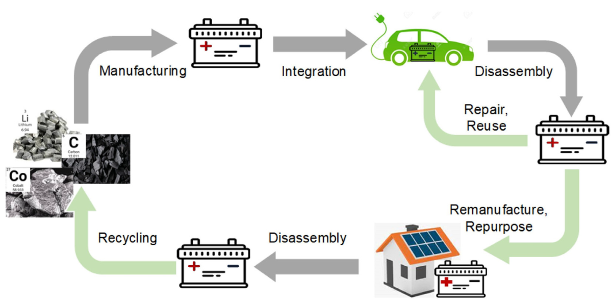
Drones: a helping hand from above for road monitoring
The A35 Brebemi (Brescia, Bergamo, Milan) Italian highway, part of the international Aleatica group, has implemented the "Drone Asset and Traffic Monitoring Project," a highway monitoring service that uses drones to collect real-time information on infrastructure and traffic conditions.
 Gianluca Speziale
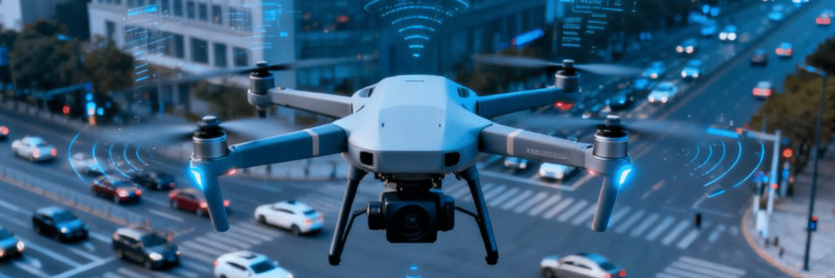
More specifically, every day a drone flies—at specific times during the day and night—at an altitude of 120 meters above the two lanes, enabling the relevant authorities to monitor the situation and intervene as quickly as possible in case of need and/or emergencies.
This allows the technicians of A35 Brebemi to monitor in real-time not only the traffic conditions but also the state of the pavement, noise barriers, and fencing networks. The live images transmitted by the drones make it possible to “quickly identify the presence of traffic jams, stationary vehicles, or obstacles on the roadway and optimize intervention management, further enhancing user safety.” In short, an advanced system that represents another step forward in ensuring highway safety for A35 Brebemi and Aleatica.
This is just the culmination of a project that began in October 2024 and was developed in three phases. Initially, the system was tested by deploying drones piloted directly by specialized personnel, with video streams being collected at Brebemi’s Control Room. In the second phase, the drones were piloted remotely from a Control Center, ensuring the direct transmission of data. Finally, at the current stage, the system has become fully automated: the drones take off and land autonomously from dedicated hangars, with the ability to schedule planned missions or carry out immediate interventions from Brebemi’s Control Center.
Drone technology
Modern drones are equipped with features that make them ideal for traffic monitoring.
Firstly, the high-resolution cameras provide clear visual data for analysing traffic flow and detecting incidents, while the possibility of thermal imaging are useful for night-time or low-visibility conditions. In addition to cameras, they may carry LiDAR, radar, or pollution sensors. Drones can stream live footage to control centres thanks to real-time data transmission.
Many drones can follow pre-programmed routes or use AI to respond dynamically to traffic conditions with autonomous flight. Another interesting point is the battery, whose technology has improved, with some drones capable of 40-60 minutes of flight per charge, and tethered drones offering indefinite flight times.
Versatility and performance
Drones are versatile and can perform a variety of traffic monitoring tasks.
As previously stated for the A35 Brebemi highway, the drones can be used for incident detection and management, spotting accidents or breakdowns quickly to dispatch help.
Analysing traffic flow, drones identify congestion points and optimize signal timings.
Another use is infrastructure inspection, that is checking roadways, bridges, and signs for maintenance needs and event traffic management: monitoring large gatherings or sporting events for effective crowd and vehicle flow control. Tracking speeding vehicles, illegal parking, or unauthorized road use can help local police authorities.
AI and digital data connections
Drones are increasingly integrated into broader smart city ecosystems. They capture data that is processed by AI to generate actionable insights. AI is also used for pattern recognition, traffic prediction, and incident detection. Real-time updates can adjust traffic signals or inform drivers via apps. In addition, drones complement fixed traffic cameras, ground sensors, and satellite imagery for a holistic view. The use of 5G networks ensures low-latency data transfer for real-time monitoring, as well as edge computing allows drones to process data locally, reducing bandwidth needs.
Advantages and limitations
The use of drones, however, offers several advantages but faces some limitations.
From battery limits, where flight time still restricts prolonged monitoring without tethering, (tethered drones address the battery issue and provide uninterrupted coverage), to regulatory hurdles, where airspace restrictions, privacy concerns, and permits vary by region.
From the cost, high-quality drones and sensors are expensive, and skilled operators are needed, to weather dependency, in fact heavy rain, strong winds, or extreme temperatures can affect drone performance. Finally, data processing, where managing and analysing the vast amount of data drones collect requires robust systems.